
Category:Landsat
American network of Earth-observing satellites for international research purposes  | |||||
| Upload media | |||||
| Instance of | |||||
|---|---|---|---|---|---|
| Has part(s) | |||||
| |||||
Subcategories
This category has the following 16 subcategories, out of 16 total.
1
2
3
4
5
6
- Landsat 6 (17 F)
7
8
9
I
M
- Multispectral Scanner (13 F)
N
- Landsat Next (22 F)
R
- Return-Beam Vidicon (2 F)
T
- Valerie L. Thomas (6 F)
Media in category "Landsat"
The following 32 files are in this category, out of 32 total.
-
50- years of Landsat- Las Vegas (SVS31195).webm 27 s, 3,840 × 2,160; 83.78 MB
-
.jpg/120px-Landsat_vegetation_classification_map_of_the_Arizona_Strip_District_(1980).jpg) Landsat vegetation classification map of the Arizona Strip District (1980).jpg 3,056 × 3,320; 629 KB
Landsat vegetation classification map of the Arizona Strip District (1980).jpg 3,056 × 3,320; 629 KB
-
At Land's Edge - Tracking Coastal Ecosystem with Landsat (SVS14903).webm 5 min 4 s, 1,920 × 1,080; 211.4 MB
-
 ERT - LANDSAT SATELLITE AND LAKE MICHIGAN - NARA - 17426523.jpg 6,217 × 4,846; 26.46 MB
-
 ERT - LANDSAT SATELLITE AND LAKE MICHIGAN - NARA - 17426525.jpg 6,199 × 4,846; 28.52 MB
-
 Focal plane projection on ground track.png 1,339 × 1,689; 143 KB
-
Guardian Landsat - Firewatch (SVS14712).webm 8 min 46 s, 1,920 × 1,080; 69.7 MB
-
 Land Sat satellite at the Asteroid Grand Challenge anniversary event 2015.jpg 4,746 × 3,159; 7.04 MB
-
Landsat 1-3 Ground Stations.webm 9.1 s, 654 × 486; 3.09 MB
-
Landsat 2023- A Year in Review (SVS14526).webm 6 min 18 s, 1,920 × 1,080; 49.98 MB
-
Landsat 40th.ogv 7 min 26 s, 640 × 360; 85.94 MB
-
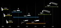
 Landsat Missionen.jpg 900 × 216; 99 KB
-
 Landsat program timeline.png 3,200 × 1,282; 781 KB
-
.png/120px-Landsat_TDRSS_Coverage_(amf-e7e7038e-ceb1-4458-809d-9c93512f91d9).png) Landsat TDRSS Coverage (amf-e7e7038e-ceb1-4458-809d-9c93512f91d9).png 1,500 × 2,100; 357 KB
Landsat TDRSS Coverage (amf-e7e7038e-ceb1-4458-809d-9c93512f91d9).png 1,500 × 2,100; 357 KB
-
 Landsat-program-timeline-in-2021.jpg 1,334 × 628; 180 KB
-
 Multispektralabtaster02.jpg 300 × 410; 84 KB
-
NASA ARSET- Deriving NDVI from Landsat, Part 2-4 (elPbB8k2Sxg).webm 53 min 15 s, 1,280 × 720; 133.84 MB
-
.jpg/120px-OCC_downlinks_(Landsat).jpg) OCC downlinks (Landsat).jpg 1,280 × 843; 186 KB
OCC downlinks (Landsat).jpg 1,280 × 843; 186 KB
-
.png/120px-Orbit_Globe_(Landsat).png) Orbit Globe (Landsat).png 600 × 431; 31 KB
Orbit Globe (Landsat).png 600 × 431; 31 KB
-
 Orbit Globe Diagram.png 600 × 431; 29 KB
-
 Orbit Path Globe 2.png 600 × 405; 54 KB
-
 Orbit Path Technical Diagram.png 600 × 446; 53 KB
-
.jpg/120px-Pepel_Island_-_Marplot_Map_With_PGS_Shorelines_(1-30%2C000).jpg) Pepel Island - Marplot Map With PGS Shorelines (1-30,000).jpg 1,240 × 904; 316 KB
Pepel Island - Marplot Map With PGS Shorelines (1-30,000).jpg 1,240 × 904; 316 KB
-
 Remotesensing-11-01502-v2.pdf 1,239 × 1,752, 23 pages; 5.23 MB
-
 Runcorn.jpg 3,600 × 3,600; 10.94 MB
-
 The spectral band placement for each sensor of Landsat.jpg 1,199 × 531; 221 KB
-
Virginia Norwood and the Little Scanner that Could (SVS14187).webm 6 min 46 s, 1,920 × 1,080; 52.76 MB
-
 Worldwide Reference System Grid Boundaries.png 570 × 389; 27 KB
-
 Wr3-grid.png 570 × 389; 29 KB
-
 X-Band Communications Subsystems.png 1,920 × 1,080; 407 KB
-
.png/120px-Your_Name_In_Landsat_(SVS31350).png) Your Name In Landsat (SVS31350).png 1,920 × 1,080; 1.88 MB
Your Name In Landsat (SVS31350).png 1,920 × 1,080; 1.88 MB
-
Your Name In Landsat (SVS31350).webm 19 s, 3,840 × 2,160; 20.87 MB
.jpg)


.png)


.jpg)
.png)


.jpg)


.png)